 Movie
Movie 2 months ago
709
2 months ago
709 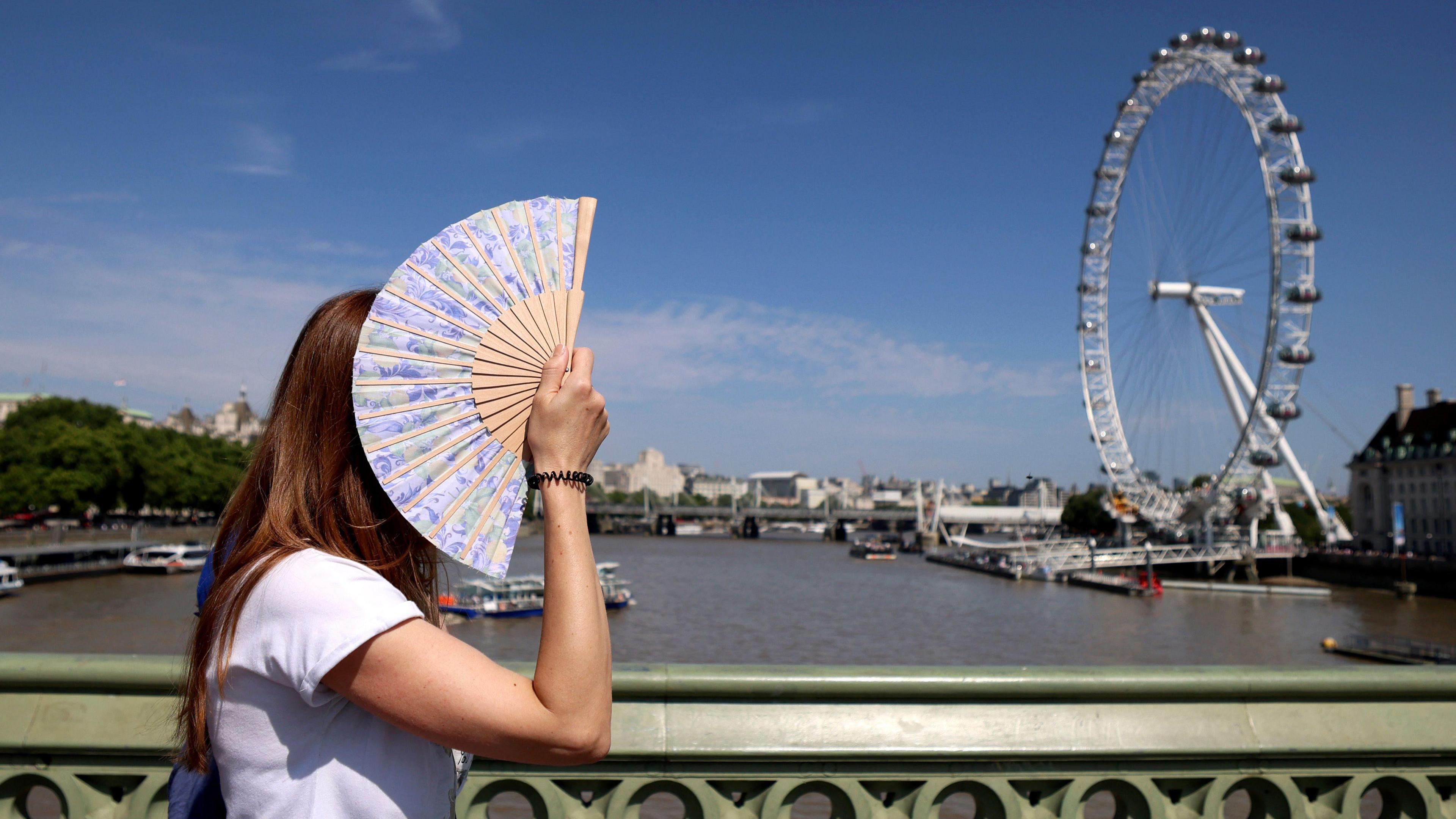 Image source, Andy Rain/EPA/Shutterstock
Ben Rich
Lead Weather Presenter
The Met Office has confirmed that summer 2025 is officially the hottest on record for the United Kingdom.
Provisional statistics show that the mean temperature across the country - which includes overnight lows as well as daytime highs - was 16.10C (60.98F).
This is 1.51C (2.72F) above the long-term average and well ahead of 2018, the previous warmest summer, which had a mean temperature of 15.76C (60.37F).
It is in line with evidence that summers are getting hotter and drier because of climate change.
Met Office climate scientists have found that a summer as hot or hotter than 2025 is now seventy times more likely than it would have been in a "natural" climate, with no human-induced greenhouse gas emissions.
2025 has pushed the famous summer of 1976 out of the UK top-five, meaning the five hottest summers have all occurred since 2000.
A summer of four heatwaves
The highest temperature of the summer was 35.8C (96.4F), recorded at Faversham, Kent on 1 July.
This may seem relatively modest compared with some of the exceptional highs of previous years, including the record-breaking 40.3C (104.5F) recorded in July 2022.
However what is notable about this summer is how long-lasting and widespread the heat has been - with temperatures widely meeting heatwave criteria on four separate occasions.
The heat started early with a June heatwave which brought highs above 33C (91F) for the summer solstice.
The mercury then climbed again later in the month with Wimbledon seeing its hottest start to the tournament on record.
A brief cooler spell in early July was followed by a third heatwave which brought Scotland, Northern Ireland and Wales their hottest weather of the year.
A fourth heatwave in August brought temperatures of 33.4C (92.1F) in parts of England, while 31.6C (88.9F) at Charterhall, Borders, was Scotland's highest August temperature since 2003.
The warmth was often accompanied by blue skies with sunshine amounts above average across most of the UK.
Dry overall but with big variations
Provisional Met Office figures show that the UK as a whole had 84% of its typical summer rainfall.
However, the pattern has been variable.
Central, eastern and southern parts of England have been exceptionally dry while northern and western areas of the UK - especially Scotland - have been much wetter.
Hosepipe bans are in force across large parts of England - partly because the dry hot summer has followed the UK's driest spring in more than 50 years.
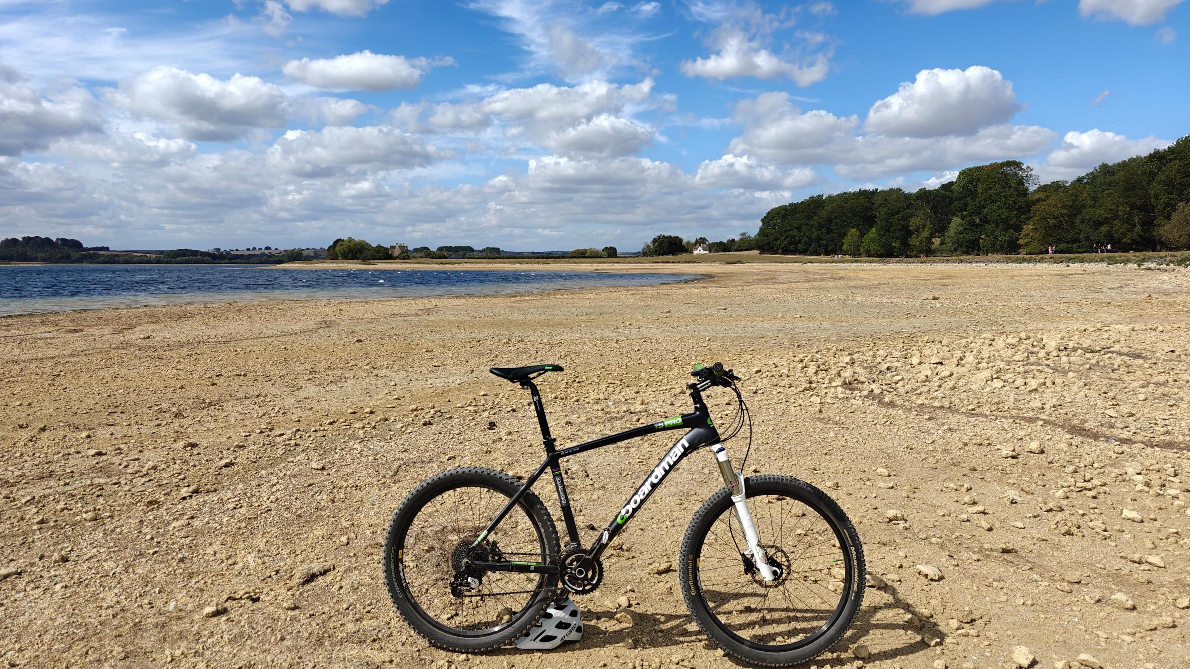 Image source, BBC Weather Watchers / Fife on a Bike
The long dry spell has left water levels at Rutland Water exceptionally low
The story has not been entirely straightforward though.
Heavy downpours and thunderstorms caused flash flooding for some places during July.
Meanwhile it was a stormy start to August as Storm Floris brought gusts of over 80mph (130km/h) to parts of the UK.
This was an unusually strong storm for the time of year and brought widespread disruption, especially in Scotland.
Many areas also ended the summer with rain as low pressure took charge for the end of August.
Is climate change to blame?
There are a number of reasons why this summer was so warm.
High pressure was regularly overhead, meaning long spells of dry, calm, sunny weather.
The dry ground also helped temperatures to climb.
Less of the Sun's energy was used in evaporating moisture leaving more to heat the ground and the air.
A marine heatwave also played a part with sea temperatures in parts of the UK up to 3C above normal at times, reducing the usual cooling effect around the coast.
However, scientists are clear that climate change is making our summers hotter and drier.
Nine of the last 10 summers (2016-2025) have brought temperatures above the long-term norm.
The number of very hot days with temperatures above 30C (86F) has more than trebled in the most recent decade compared with the 1961-1990 average.

Click here to play 'Cooler than me?'


![Presidents Day Weekend Car Sales [2021 Edition]](https://www.findthebestcarprice.com/wp-content/uploads/Presidents-Day-Weekend-car-sales.jpg "Presidents Day Weekend Car Sales [2021 Edition]")


 English (United States)